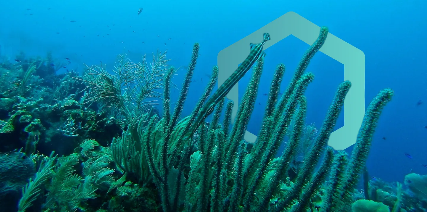
Monitor habitats over time with powerful geospatial insights
Track ecosystem restoration, land cover changes, and nature-based solutions at scale


.svg)


.svg)


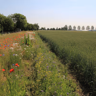
Run rapid assessments of complex, hard-to-reach terrestrial sites, showing change over time.
Standardize habitat assessments across portfolios, identifying areas of interest.

Compare habitat insights alongside species data to simplify reporting for CSRD, TNFD and GRI.
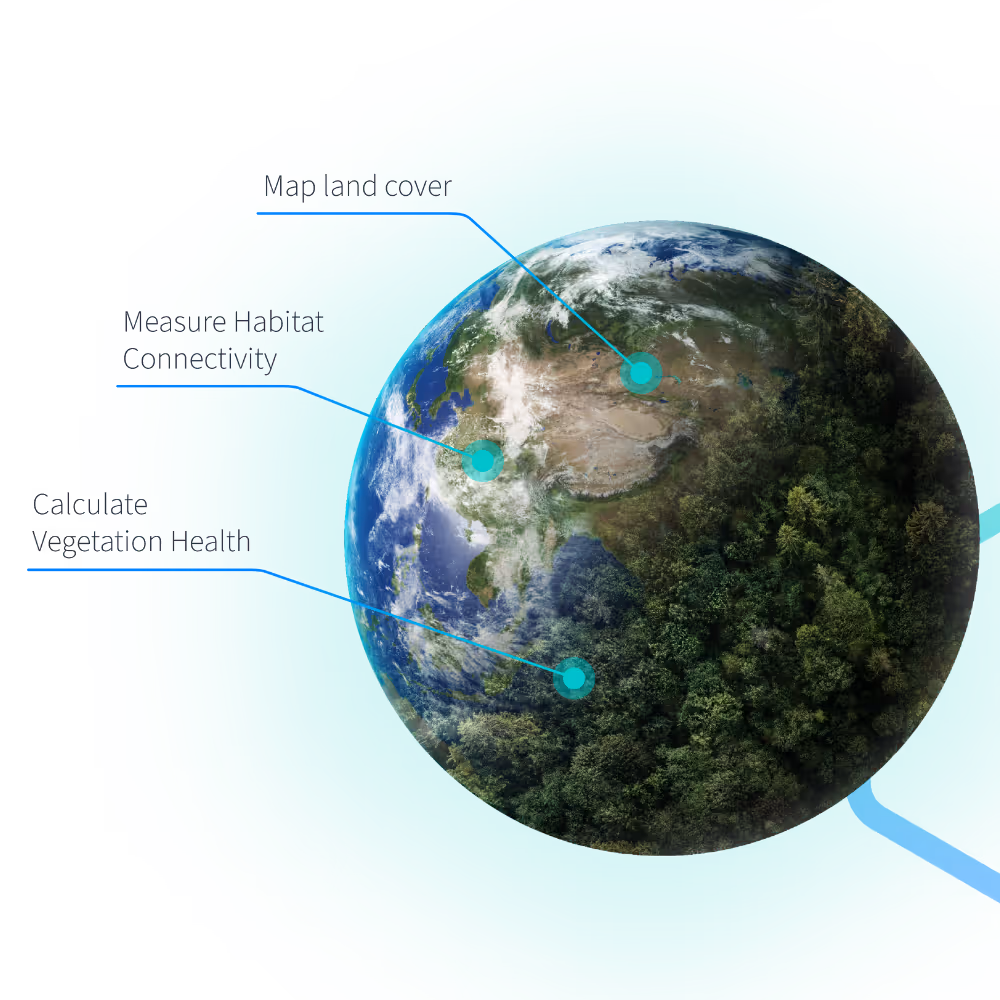
Unlock Habitat Insights from Geospatial Data
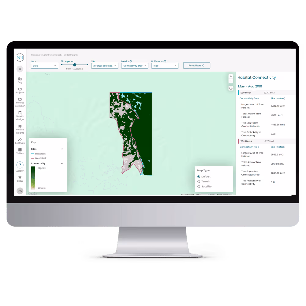
Habitat connectivity
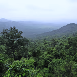
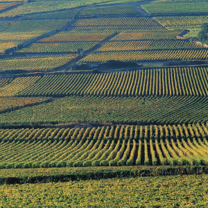
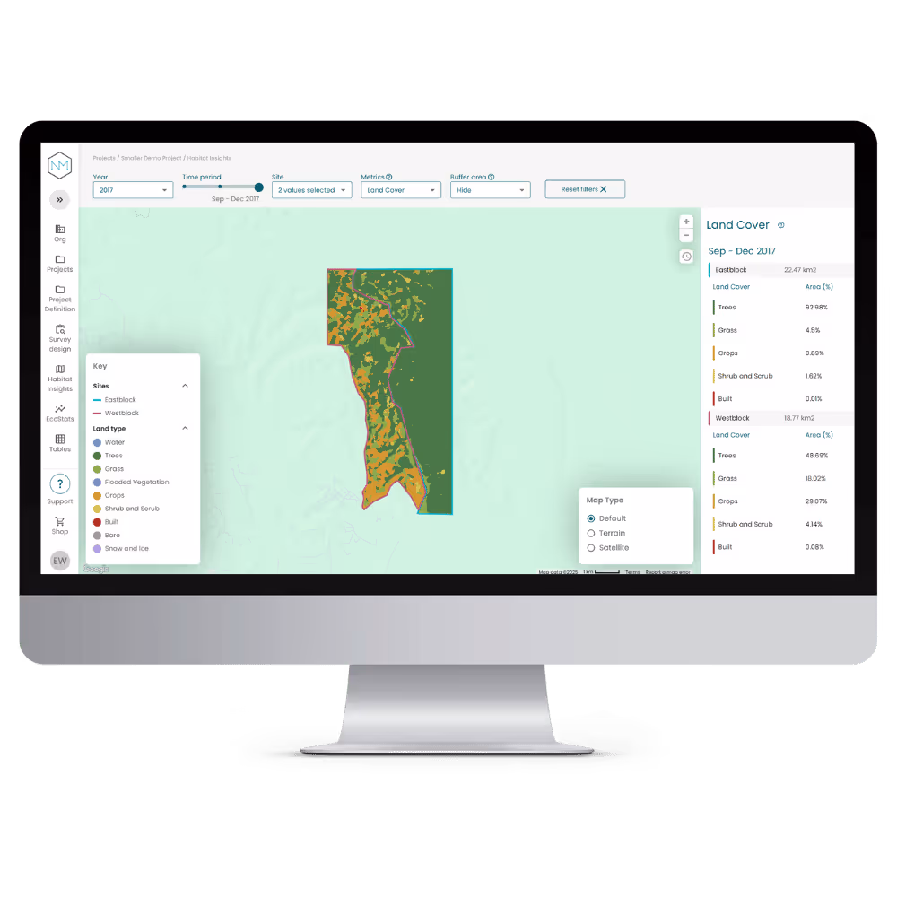
Habitats and land use change
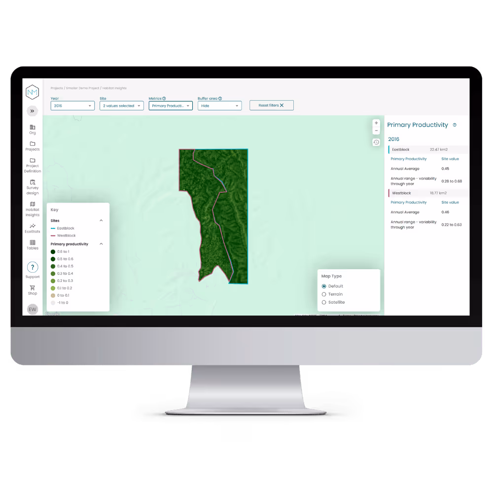
Vegetation health (EVI)
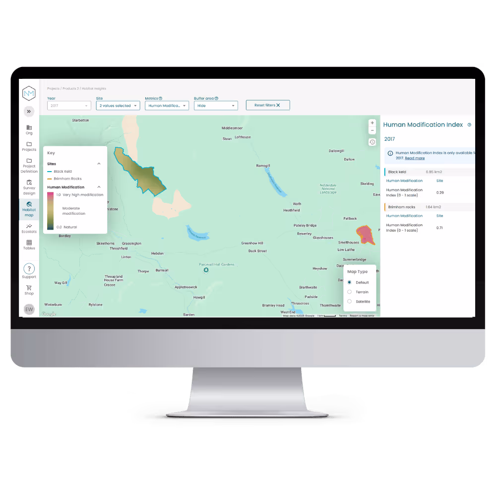
Human Modification Index (HMI)
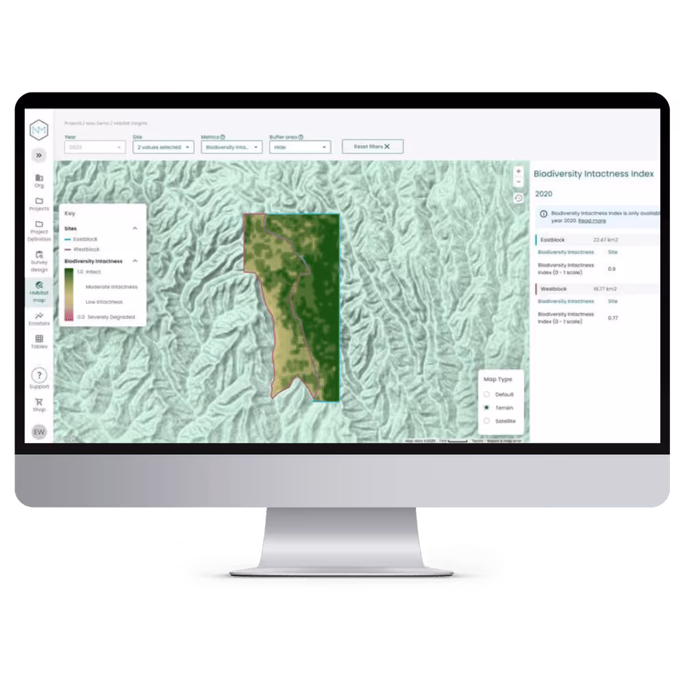
Biodiversity Intactness Index (BII)
Make better decisions in less time by combining species & habitat data in one place
Customers using NatureMetrics eDNA monitoring services can choose to view Habitat Insights in the same platform as their eDNA survey results.
Scalable & Cost-Effective
Reduce expensive, time-consuming field surveys while ensuring high-quality biodiversity insights.

Historical & Real-Time Tracking
Assess land use changes over time to measure conservation impact from past to present.

Compliance & Reporting
Standardised data outputs aligned with TNFD, GRI, and biodiversity credit frameworks
Nature-based Solutions (NbS)
Provide data-driven evidence for carbon credits, reforestation and biodiversity restoration projects.
Who can benefit from Geospatial Solutions for Habitat Monitoring

Ecologists & Conservation Scientists
Track biodiversity & ecosystem changes with species & habitat data to inform conservation strategies and stakeholder collaboration.

Site Managers & Landowners
Standardise biodiversity monitoring and demonstrate nature performance over time to meet sustainability commitments.

Principal Ecologists & Portfolio Managers
Ensure consistent, scalable biodiversity data across multiple sites for streamlined reporting and analysis.
Biodiversity Credit Project Developers
Provide transparent, verifiable data to support certification for biodiversity credits.
Carbon Credit Project Developers
Track biodiversity & ecosystem changes with species & habitat data to inform conservation strategies and stakeholder collaboration.

Corporate & ESG Leaders
Align with global biodiversity and sustainability disclosure frameworks, ensuring compliance with TNFD, GRI, and other regulatory requirements.


FAQ's
By using satellite imagery and remote sensing, this solution measures land cover changes, habitat connectivity, and vegetation health over time. It provides cost-effective, large-scale monitoring without the need for frequent field surveys.
Unlike traditional GIS mapping tools, this platform uniquely integrates eDNA species monitoring with geospatial habitat analysis, providing a complete picture of biodiversity and ecosystem function in one place.
Unlike traditional GIS mapping tools, this platform uniquely integrates eDNA species monitoring with geospatial habitat analysis, providing a complete picture of biodiversity and ecosystem function in one place.
This geospatial solution delivers three key habitat metrics:
Land Cover Monitoring – Tracks changes in habitat types (e.g., woodland, shrubland, water).
Habitat Connectivity – Measures landscape connectivity to support wildlife movement.
Vegetation Index (EVI) – Assesses plant health as a proxy for habitat condition
The platform provides standardised, repeatable, and regulatory-aligned data that meets the requirements of:
Taskforce on Nature-related Financial Disclosures (TNFD)
Global Reporting Initiative (GRI)
Verra Nature Credits & Carbon Credit Standards
EU & UK Biodiversity Net Gain (BNG) Policies
Demo Habitat Insights